Nature trails

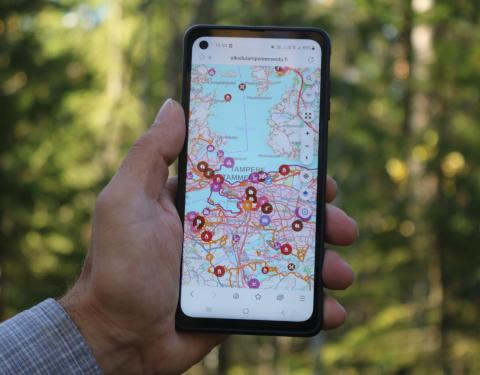
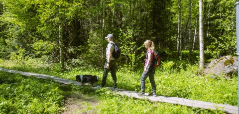
Nature trails can be explored both independently and by participating in organized excursions. Information boards describing the nature of the areas can be found along the Niihama nature trail, which was renovated in 2020, the new Lake Koukkujärvi nature trail, which was established in Vuores in 2019, and the Tammerkoski nature trail, which was completed in 2018.
Nature trails
Showing locations 0/0
No results
Hervantajärvi and Suolijärvi nature trails
The Suolijärvi nature trail in Hervanta currently runs in its entirety along the shoreline of the lake. The trail is about 4.5 km long, and many types of marsh and grove plants can be found along the route. In places, the Lake Suolijärvi landscape is powerfully shaped by steep cliffs and massive boulders.
The Hervantajärvi nature trail, on the other hand, is located south of Ruskontie and is mostly within the Makkarajärvi-Viitastenperä nature reserve. The trail is about four kilometres long, but there are several alternative routes that offer a slightly longer journey. The nature trail is part of the Southern Häme grove-rich area. It features rocky and peaty forests, marshes, groves and shore zones rich in common alder. The trail also runs around Lake Makkarajärvi, which is located in the middle of a raised bog.
Härmälä nature trail
The nature trail from the Härmälä Beach is about 2 kilometres long, and along the route you can admire the lake landscape visible from between the trees. On the shores of Lake Pyhäjärvi, you can see several species that have escaped into the wild from people’s gardens. In the early 20th century, the area was popular for holiday villas. Please note that the some of the checkpoints along the trail have disappeared and the route markers have faded, so it may be difficult to follow the route. However, there are plenty of alternative paths that run next to each other. The terrain is partly hilly and has a lot of roots on the ground, so this should be taken into account when exploring the route. There are parking options for car or bicycle, such as the parking lot on Härmälä Beach. There are also local buses that run close to the starting point.
Lake Iidesjärvi nature trail
Iidesjärvi is Tampere's most famous lake for birdwatching. It covers an area of around 65 hectares. A birdwatching tower was built at the eastern end of the lake in 1992. The Lake Iidesjärvi nature trail starts from the bird tower and is about 7 kilometres long. In addition to birdwatching, the route offers meadows, swamp meadows and shore thickets with their varied vegetation.
Lake Koukkujärvi nature trail in Vuores
Koukkujärvi is a small forest lake in Vuores that is circled by a nature trail of about 1.5 kilometres. Along the route, there are nine information boards that give you the chance to ‘dive’ deeper into the surrounding nature. Duckboards have been laid out in the wettest areas of the trail. The shores of Koukkujärvi are mostly marshy, so you can find there plants and berries such as wild rosemary, marsh violet, cloudberries and cranberries. The nature trail passes through an almost treeless open swamp and an alder stand that is a protected nature reserve. If you are lucky, you can spot a protected lilypad whiteface dragonfly.
Niihama nature trail
The nature trail that starts from Niihama recreational lodge runs through the wooded terrain around Lake Niihamajärvi and Soukonvuori. The length of the trail is about 3 kilometres and it features a main information board and also 11 smaller ones dotted along the route. Along the route you can find both fresh and dry peaty forest, birch stands and groves. Lake Niihamajärvi, which can be glimpsed between the trees, is gradually turning into a swamp, and its shores are lined with plants that need humidity, such as bog arum. Along the trail, you can also skirt round a marked route through the Soukonvuori nature reserve. The route map can be found on the main information board in the courtyard of Niihama lodge, and the route can be easily traced by following the yellow balls attached to trees and the direction arrows positioned at junction points.
Pyynikki nature trail
Pyynikki ridge is a significant geological formation and is considered to be the highest gravel ridge in the world. Pyynikki was designated as a nature reserve in 1993. Along the trail, you can get acquainted with the vegetation typical to this ridge and grove environment. The trail starts from the Pyynikki observation tower and is about 4 kilometres in length.
Please note that the checkpoints for the nature trail have partly disappeared and the trail markers have faded. There are also steep hills and steps in some places, so these should be taken into account when planning your trip. From the top of the observation tower, you can admire the view across the whole city and enjoy a break at the legendary doughnut café.
Tammerkoski nature trail
The Tammerkoski nature trail skirts the city centre from Tammerkoski Beach to Herrainmäki then via Wilhelm von Nottbeck Park to Näsinpuisto Park. The length of the trail is about 2.6 kilometres and the information boards along the route provide information about the area’s birds, plants, insects, fish and bats. The boards also tell of human influence on nature. The trail starts from the courtyard of the Vapriikki museum centre, but you can join it at any point. There are hills and steps in some places, such as Näsinpuisto Park and Herrainmäki, so these should be taken into account when planning one’s route. When exploring in winter, please note that the route does not receive full winter maintenance.
Tohloppi nature trail
The Tohloppi nature trail runs around Lake Tohloppijärvi and Epilänharju Ridge and is about 5 kilometres long. Along the trail, you can learn about the vegetation of ridges and groves, and also see different marsh and water plants. There are also two beaches located along the Tohloppi trail. The Epilänharju trail features rocky areas and hills, so the trail is not wheelchair accessible. Bicycles and cars can be parked in parking areas such as the ones at Kohmapuisto Park or Tesoma Beach. There are also local buses that can take you close to the trail.
Vaakkolammi nature trail
The Vaakkolammi nature trail runs around the lake and is approximately 2 kilometres long. While exploring the trail, you can familiarise yourself with the history, flora and fauna of Lake Vaakkolammi and the rock formation called Likokallio. The area has been designated as a valuable site in terms of its grove plants and cultural plants. Please note that the checkpoints of the nature trail have partly disappeared and the route markers have faded, so it may be difficult to follow the route. It is possible to get close to the trail on local buses.
Viikinsaari Island nature trail
Viikinsaari Island nature trail was renovated by Hopealinjat in summer 2017. The renovated nature trail is 1.3 km long and there are 14 checkpoints positioned along it which tell about the nature of the island. The checkpoints also feature tasks for little ones and other playful souls. In addition to the nature trail, there is also a meditation path on Viikinsaari Island, which features its own checkpoints with activities. Maps of Viikinsaari Island can be obtained from the information point in the area, and you can also book a guided tour from Hopealinjat. You can go to the island on the Hopealinjat boats that run from Laukontori Harbour.
Showing all locations 10/10
Showing locations 10/10
No results
The Suolijärvi nature trail in Hervanta currently runs in its entirety along the shoreline of the lake. The trail is about 4.5 km long, and many types of marsh and grove plants can be found along the route. In places, the Lake Suolijärvi landscape is powerfully shaped by steep cliffs and massive boulders.
The Hervantajärvi nature trail, on the other hand, is located south of Ruskontie and is mostly within the Makkarajärvi-Viitastenperä nature reserve. The trail is about four kilometres long, but there are several alternative routes that offer a slightly longer journey. The nature trail is part of the Southern Häme grove-rich area. It features rocky and peaty forests, marshes, groves and shore zones rich in common alder. The trail also runs around Lake Makkarajärvi, which is located in the middle of a raised bog.
The nature trail from the Härmälä Beach is about 2 kilometres long, and along the route you can admire the lake landscape visible from between the trees. On the shores of Lake Pyhäjärvi, you can see several species that have escaped into the wild from people’s gardens. In the early 20th century, the area was popular for holiday villas. Please note that the some of the checkpoints along the trail have disappeared and the route markers have faded, so it may be difficult to follow the route. However, there are plenty of alternative paths that run next to each other. The terrain is partly hilly and has a lot of roots on the ground, so this should be taken into account when exploring the route. There are parking options for car or bicycle, such as the parking lot on Härmälä Beach. There are also local buses that run close to the starting point.
Iidesjärvi is Tampere's most famous lake for birdwatching. It covers an area of around 65 hectares. A birdwatching tower was built at the eastern end of the lake in 1992. The Lake Iidesjärvi nature trail starts from the bird tower and is about 7 kilometres long. In addition to birdwatching, the route offers meadows, swamp meadows and shore thickets with their varied vegetation.
Koukkujärvi is a small forest lake in Vuores that is circled by a nature trail of about 1.5 kilometres. Along the route, there are nine information boards that give you the chance to ‘dive’ deeper into the surrounding nature. Duckboards have been laid out in the wettest areas of the trail. The shores of Koukkujärvi are mostly marshy, so you can find there plants and berries such as wild rosemary, marsh violet, cloudberries and cranberries. The nature trail passes through an almost treeless open swamp and an alder stand that is a protected nature reserve. If you are lucky, you can spot a protected lilypad whiteface dragonfly.
The nature trail that starts from Niihama recreational lodge runs through the wooded terrain around Lake Niihamajärvi and Soukonvuori. The length of the trail is about 3 kilometres and it features a main information board and also 11 smaller ones dotted along the route. Along the route you can find both fresh and dry peaty forest, birch stands and groves. Lake Niihamajärvi, which can be glimpsed between the trees, is gradually turning into a swamp, and its shores are lined with plants that need humidity, such as bog arum. Along the trail, you can also skirt round a marked route through the Soukonvuori nature reserve. The route map can be found on the main information board in the courtyard of Niihama lodge, and the route can be easily traced by following the yellow balls attached to trees and the direction arrows positioned at junction points.
Pyynikki ridge is a significant geological formation and is considered to be the highest gravel ridge in the world. Pyynikki was designated as a nature reserve in 1993. Along the trail, you can get acquainted with the vegetation typical to this ridge and grove environment. The trail starts from the Pyynikki observation tower and is about 4 kilometres in length.
Please note that the checkpoints for the nature trail have partly disappeared and the trail markers have faded. There are also steep hills and steps in some places, so these should be taken into account when planning your trip. From the top of the observation tower, you can admire the view across the whole city and enjoy a break at the legendary doughnut café.
The Tammerkoski nature trail skirts the city centre from Tammerkoski Beach to Herrainmäki then via Wilhelm von Nottbeck Park to Näsinpuisto Park. The length of the trail is about 2.6 kilometres and the information boards along the route provide information about the area’s birds, plants, insects, fish and bats. The boards also tell of human influence on nature. The trail starts from the courtyard of the Vapriikki museum centre, but you can join it at any point. There are hills and steps in some places, such as Näsinpuisto Park and Herrainmäki, so these should be taken into account when planning one’s route. When exploring in winter, please note that the route does not receive full winter maintenance.
The Tohloppi nature trail runs around Lake Tohloppijärvi and Epilänharju Ridge and is about 5 kilometres long. Along the trail, you can learn about the vegetation of ridges and groves, and also see different marsh and water plants. There are also two beaches located along the Tohloppi trail. The Epilänharju trail features rocky areas and hills, so the trail is not wheelchair accessible. Bicycles and cars can be parked in parking areas such as the ones at Kohmapuisto Park or Tesoma Beach. There are also local buses that can take you close to the trail.
The Vaakkolammi nature trail runs around the lake and is approximately 2 kilometres long. While exploring the trail, you can familiarise yourself with the history, flora and fauna of Lake Vaakkolammi and the rock formation called Likokallio. The area has been designated as a valuable site in terms of its grove plants and cultural plants. Please note that the checkpoints of the nature trail have partly disappeared and the route markers have faded, so it may be difficult to follow the route. It is possible to get close to the trail on local buses.
Viikinsaari Island nature trail was renovated by Hopealinjat in summer 2017. The renovated nature trail is 1.3 km long and there are 14 checkpoints positioned along it which tell about the nature of the island. The checkpoints also feature tasks for little ones and other playful souls. In addition to the nature trail, there is also a meditation path on Viikinsaari Island, which features its own checkpoints with activities. Maps of Viikinsaari Island can be obtained from the information point in the area, and you can also book a guided tour from Hopealinjat. You can go to the island on the Hopealinjat boats that run from Laukontori Harbour.
Updated 30.12.2022