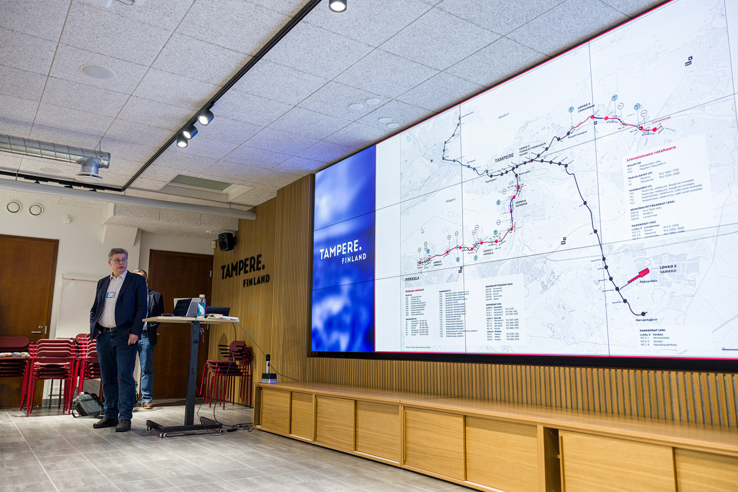
- At the moment, the available street plan proposals include the section on Hatanpään valtatie and the plans for Lääkärinkatu, Heikkilänkatu, Mäentakusenkatu and Aitolahdentie on the Linnainmaa branch. The town plan draft for the west side of Lake Alasjärvi and the related Kaupinlaakso boulevard street plan draft will also become available at the same time until the 26 April, says Jouni Sivenius, Head of Planning of Municipal Engineering for the City of Tampere.
You can leave feedback in the registry office of the City of Tampere where feedback related to town plans and street plan drafts is also given.
The feedback received about the street plans will be used in the planning
On the website of Tampere Tram’s Pirkkala–Linnainmaa Alliance and public events, it has already been possible to comment on the street plan proposal drafts that will now become available. The Alliance has also had multiple negotiations with properties, services and other parties that work along the new tram route, and many changes have been made based on their feedback.
- We have received feedback from the public about the number and locations of stops, access to the stops and about the green areas on the streets. We tend to get a lot of detailed feedback on the bicycle path arrangements. Also the arrangements for different junction areas have come up, says Ville-Mikael Tuominen, Development Director of Tampere Tramway Ltd.
There have not been any significant changes concerning the stops and there are no plans to change them anymore. The number and locations of the stops are based on current and future land use. Also the current number of residents, workplaces and services in the stop’s area of influence, as well as an estimation of their development in the future, have been taken into account.
Based on the received feedback, pedestrian and bicycle paths and signs has been improved, for example. Modifications have also been done in the junction areas to improve smooth traffic flow and security, and the length of the lanes for turning has been examined and there has been an aim to clarify the lane arrangements. From the point of view of winter maintenance, the solutions have been thoroughly improved.
The driving factors for planning the junction areas are safety and smooth traffic flow at the junction.
- Questions have arisen on the flow of traffic at the Tampereen valtatie and Hatanpään valtatie junction, for example. Tampere City Board already defined earlier that the tram traffic will be done on its own lane on the same level with other traffic but that the tram traffic benefit for traffic lights will be cut down during the busiest hours, which will make all traffic smoother, says Tuominen.
The tramway will have its own lane on Hatanpään valtatie, changes on the junctions
The tramway rail on Hatanpään valtatie is planned to be continued from the current rail by the bus station. The tramway runs in the middle of the current street in its own lane. The plan for Hatanpään valtatie is to mainly have one car lane in both directions and additional turning lanes in conjunctions. The street levelling will mainly follow the current height level. There will be green lanes with tree plantings on the sides of the tramway area. The regional main bicycle route will be on the west side of Hatanpään valtatie.
There will be three tram stops on Hatanpään valtatie: On the south side of Viinikanoja bridge, on the north side of Hatanpäänkatu junction and on the south side of Siirtolapuutarhankatu. There is also bus traffic on Hatanpään valtatie, and the bus stops will be carried out as extensions. In the arrangements for stops, the connections to Hatanpään sairaala have been taken into account.
A tramway turning point is being planned for on Hatanpään valtatie on the north side of the Tampereen valtatie junction. The tramway will be on the same level with other traffic on the Tampereen valtatie and Hatanpään valtatie junction, but during rush hours the traffic light benefit of the tramway will be adapted to the queueing sensitivity of the junction to smooth all traffic.
Along with the tramway, changes have been planned for many junction arrangements. For example, junctions for facilities will be changed into one-way junctions where it is only possible to turn right and not to cross the tramway rail. Junctions that cross the tramway will be equipped with traffic lights and they will have a zebra crossing. The plan for Hatanpään valtatie has been specified based on the received feedback, for example, by keeping the pedestrian bridge crossing Viinikanoja which was originally proposed to be removed.
Street plan proposals for Lääkärinkatu, Heikkilänkatu and Mäentakusenkatu are available
The tramway that is planned to be continued from the current final stop in Kauppi campus is located on the south side of Lääkärintie. On the east side of the Arvo Ylpön katu junction on Lääkärinkatu, the tramway will run in the middle of the street in its own lane. On the sides of the rail, there will be green lanes of varying widths with planted trees. At junctions, the single car lanes will have separate lanes for the left turn. The roundabout of Arvo Ylpön katu and Lääkärinkatu will become a four-way junction guided by traffic lights. A tramway stop is planned at the east end of Lääkärinkatu, near Tenniskeskus.
In the area between Arvo Ylpön katu, Lääkärinkallionkatu and Lääkärinkatu, there will be a power station for the tramway and a turning point for buses. The tramway rail section between Arvo Ylpön katu and Toimelankatu will be covered with crushed stone. The regional main bicycle route and the pedestrian path will be on the north side of Lääkärinkatu.
The current bus stop at Teiskontie on the west side of Heikkilänkatu junction will stay and have a new connection from the direction of Heikkilänkatu. The Heikkilänkatu and Luhtaankatu junction has been planned to have traffic lights. A tramway stop is also planned on Heikkilänkatu before the new tramway bridge that crosses the eastern bypass (Valtatie 9) and which will be on the north side of the current bridge. On the south side of the tramway, there will be a new pedestrian and bicycle lane leading to Linnainmaa and which is part of the regional main bicycle route.
The Heikkilänkatu, Aitolahti and Mäentakusenkatu junction is planned as a roundabout with the tramway going through it. At the roundabout, car traffic, the bicycle traffic and pedestrians crossing the rail will be stopped with traffic lights when a tramway passes it. A significant connection stop has been planned on Mäentakusenkatu where northern, southern and eastern bus lines meet the tramway.
The new street connection planned on the north side of Citymarket and that would pass the connection stop area will be presented together with the town plan. Access to the junction to the property next to the stop is planned to be on the side of Lahtomäenkatu and Länkinotkonraitti. The Lahtomäenkatu junction has been planned to have traffic lights. A turning point for the trams has been planned after the connection stop which works as a final stop on the north side of Mäentakusenkatu. The street levelling will mainly follow the current height level.
Based on the feedback on the Linnainmaa rail branch, there has been an attempt to clarify the turning lane lengths and lane arrangements in Mäentakusenkatu, for example.
A street plan draft available for the west side of Lake Alasjärvi
The street plan draft for the west side of Lake Alasjärvi will become available together with the area’s town plan. The area’s tramway road, Kaupinlaakso boulevard, has been planned to run through the Ruotula golf course which will be removed, and the tramway road would be located approximately a hundred metres north of the current Teiskontie (Valtatie 12). The tramway route is located in the middle of the new street. Both sides of the road have lines of trees between the lane and bicycle path as well as separate pedestrian and bicycle paths.
A tramway stop has been planned in the middle of the new residential area in the town plan on the west side of Lake Alasjärvi. The area’s street junctions are guided by traffic lights and the tramway road connects to Teiskontie through the current Jaakonmäenkatu and Irjalankatu junctions. The tramway road traffic will be calmed down by heightening the stop area.
A drive connection on the northside of Teiskontie to the shore of Lake Alasjärvi and the frisbee golf course will run from Teiskontie through the new Viheriönkatu. At the same time, it will be made possible to turn from the direction of west to north on Teiskontie. Tenniskatu will also stay as a connection to Teiskontie. Trees that are removed because of the new building will be replaced by new trees to landscape the new passages and to enable access to the Siberian Flying Squirrel.
It is possible to give feedback on the Kaupinlaakso boulevard street plan draft together with the town plan draft into the city registry office.
Decisions on building will be made in the autumn
The material produced by Tampere Tram’s Pirkkala–Linnainmaa Alliance for the decision-making of Tampere and Pirkkala Councils is going to be ready in September. By then the tramway plans will be finalised as well as the related street, stop and traffic arrangements from the Sorin aukio stop in Hatanpään valtatie until Suuppa municipality centre in Pirkkala and from Kauppi campus tramway stop in Tays area until Linnainmaa.
The goal is that in October 2024 the Alliance’s plans and reports will be ready for the Councils of Tampere and Pirkkala to use when deciding on beginning the building of the tramway, the scope of the building and the possible phases of building the rail.
Street plan proposals will be presented in public events over the spring
During the spring and summer, the final street plan proposals will be presented in public and stakeholder events organised by Tampere Tram’s Pirkkala–Linnainmaa Alliance and the City of Tampere.
Coming event:
- On Wednesday 17 April at 17–19, presentation of the plans the west side of Lake Alasjärvi and Linnainmaa depot, as well as the street plan draft for Kaupinlaakso boulevard, Kauppi campus Arvo building
Information on the planning of the tramway between Pirkkala and Linnainmaa can be found in many channels. In addition to Tampere Tram’s Pirkkala–Linnainmaa Alliance website provide information on the progress of the projects and plans as well as the coming public events.