Tampere’s skyline features airship-like flyers – and the city is building a 3D model
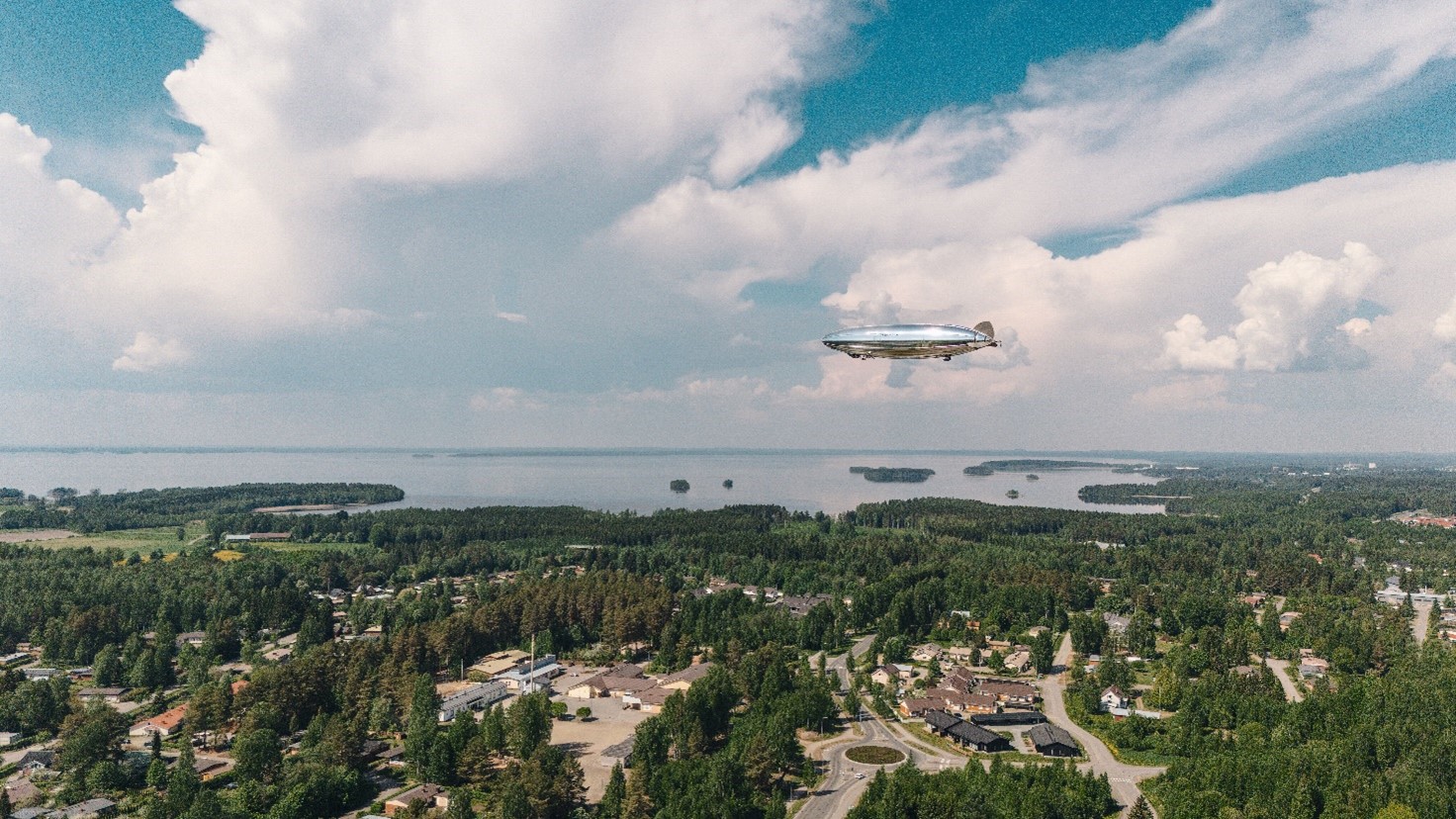
The airship-like drones will be flying at an altitude of about one hundred metres above Tampere's city center , and the photography will begin next Monday, weather permitting. The timing is subject to weather conditions, as bad weather may delay or prolong the project. The city of Tampere has commissioned the aerial photography from Kelluu Oy, a company specializing in 3D modeling, and a special permit has been obtained for the aerial photography.
– The large airships may arouse curiosity and wonder among the city's residents. The aerial photography will result in an accurate 3D 'virtual model' of the city, which will be very useful for planning future services. With the 3D model, we can better plan renovation needs, involve residents in planning, and visualize the development of the changing city, as the model allows us to perceive the environment in a multidimensional way, says Teppo Rantanen, Executive Director of Economic Policy, Competitiveness and Innovation, City of Tampere.
The aerial photography will be carried out anonymously, meaning that people cannot be identified from the images. The aerial photography will comply with the regulations of the area surveillance law.
– Our airships collect data, which is securely transmitted to our cloud services. Although the data provides a detailed analysis of human masses, people are not identifiable in it. Our high-resolution cameras do capture the environment well, but the material recorded will not be made public and will be used to create a digital twin, explains Pauli Järviluoto, System Architect at Kelluu.
The drones are quiet, so the photography will not cause noise pollution. Additionally, the drones are emission-free.
The photography will create a digital twin of the city to aid urban planning
Digital twins are 3D image models that create a virtual replica of the city. The city of Tampere wants to use new technologies innovatively in urban planning and citizen engagement.
– The growth and development of the city challenges us to find new, practical ways to improve the daily lives of residents. Creating an accurate 3D model of the city center will concretely serve the development of future services and the creation of experiential, vibrant urban environments for residents, businesses, and visitors, says Irene Impiö, Director of Innovation and Economic Policy, City of Tampere.
Digital twins are intended to support the city's vitality, for example, by providing information to businesses and residents about traffic congestion and modeling human flows in the city. The intertwining of the virtual and physical worlds of cities is called the citiverse.
– Digital twins offer new opportunities for interactive urban planning and for simulating noise, traffic, and air quality to support decision-making. In the future, city services may be widely accessible digitally in the citiverse , says Matias Ansaharju, Development Manager for the Urban Environment, City of Tampere.
Large areas can be photographed accurately and securely
Kelluu's solution utilizes the latest algorithms and enables the modeling of large areas with high resolution accurately and securely.
Kelluu has carried out a similar modeling of the city center of Joensuu.
– Digital twins are key when cities are developed smartly. Tampere is already at the forefront of citiverse thinking, and our high-resolution data enables a leap in Tampere's virtual ecosystem. The overall project will certainly be of international interest as well, says Jiri Jormakka, Sales Director at Kelluu
More information:
Irene Impiö
Director of Innovation and Economic Policy
0505392943
[email protected]


